
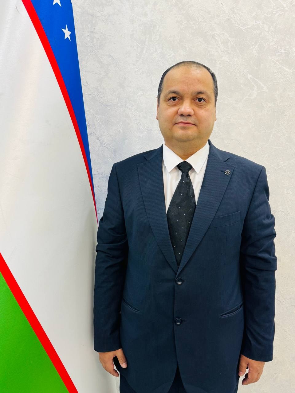
Baxodirov Zafar Abduvaliyevich
- Reception hours:
- Monday, Friday · 15:00–17:00
- Phone:
- +998 99 817-61-14
- Email:
- zafarbahodirov@gmail.com
Duties and areas of work
DEPARTMENT OF SOIL GEOGRAPHIC INFORMATION SYSTEMS AND PEDOMETRICS
The Department of Soil Geographic Information Systems and Pedometrics carries out research on studying, assessing, mapping, monitoring and managing soil resources with modern digital technologies. Its research makes integrated use of GIS, remote sensing, geostatistical analysis, digital soil mapping, mathematical modelling, artificial intelligence, Big Data and soil spectroscopy.
The department’s main research areas cover assessing soil properties and fertility, creating digital soil databases, monitoring and mapping soil degradation and erosion, placing crops optimally according to soil properties, and developing the scientific and methodological basis for efficient soil resource management. Digital maps, soil databases, models and applied software have been developed in these areas.
The department is currently carrying out major applied research on monitoring soil degradation with modern technologies and digital assessment of soil organic carbon.
Within project No. AL-9124104473 “Creating a modern technology for monitoring eroded areas using remote sensing and geo-information systems”, field and laboratory research, verification and calibration of soil erosion models, GIS-based erosion mapping and an interactive system for assessing and monitoring erosion of agricultural land are being developed.
Within project No. AL-9124104471 “Developing a technology for assessing and predicting soil organic carbon by combining direct measurements with remote sensing, artificial intelligence and soil spectroscopy”, research is under way on determining soil organic carbon by field and laboratory methods, using remote sensing and artificial intelligence, comparing soil spectroscopy data with conventional analyses and mapping the spatial distribution of organic carbon. By the end of Q1 2026 field and laboratory studies had been completed in pilot areas, a soil organic carbon database had been built and a preliminary assessment had been made with the ROTH-C model.
Introducing artificial intelligence into soil science is also an important part of the department’s work. The UzSoilAI software for rapid and efficient analysis, assessment and monitoring of soil resources is one of its key developments in this area.
The department also takes part, together with FAO, in the international project “Implementation of the RECSOIL Green Path Pilot Project in Uzbekistan (III Phase)”, carrying out field and research work on soil organic carbon, soil health and sustainable land management.
The department pays particular attention to introducing research results into practice, building digital soil databases, creating modern monitoring systems and training researchers. Its main goal is to integrate modern geo-information and digital technologies with soil science in order to assess soil resources accurately and quickly, monitor and forecast degradation and develop science-based digital solutions for the sustainable management of agriculture and land resources.
Biography
Zafar Abduvaliyevich Baxodirov — Doctor of Biological Sciences (DSc), senior researcher, head of the Department of Soil Geographic Information Systems and Pedometrics at the Institute of Soil Science and Agrochemical Research.
Zafar Abduvaliyevich Baxodirov was born on 27 March 1983 in Tashkent.
In 2002–2006 he completed a bachelor’s degree in Ecology and Nature Management at Andijan State University. In 2006–2011 he completed a master’s degree in Environmental Protection and Geographic Information Systems at the Tashkent Institute of Irrigation and Melioration. The master’s programme was an international programme run jointly with Wageningen University and Research Centre (the Netherlands) and taught mainly in English.
In 2012–2019 he carried out research in soil science at the Research Institute of Soil Science and Agrochemistry and received a PhD. He continued his soil science research in 2019–2026 and in 2026 received the degree of Doctor of Biological Sciences (DSc).
CAREER
He began his career in ecology, GIS and environmental monitoring. In 2007 he completed an internship with the UNDP project in Uzbekistan on improving a GIS-based database of environmental indicators. In 2008–2011 he was a junior specialist at the EcoGIS Centre of the Tashkent Institute of Irrigation and Melioration, and in 2011 a senior GIS specialist at the National Centre of Geodesy and Cartography of the State Committee of the Republic of Uzbekistan for Land Resources, Geodesy, Cartography and State Cadastre.
In 2012–2020 he worked as a researcher at the Research Institute of Soil Science and Agrochemistry, studying soil fertility modelling, GIS-based monitoring of land fertility, the creation of a soil geo-information and analytical system and the optimal placement of crops.
In 2013–2015 he was component leader in ICARDA’s CACILM II project, in 2014–2015 director of “Eco Expert Consulting” LLC, and in 2016–2017 a researcher at the Hydrometeorological Research Institute of the Centre of Hydrometeorological Service under the Cabinet of Ministers of the Republic of Uzbekistan.
In 2019–2021 he was head of the International Relations Department of the Research Institute of Soil Science and Agrochemistry. Since 2021 he has headed the Department of Soil Geographic Information Systems and Pedometrics.
RESEARCH
His main research areas are digital soil science, pedometrics, geographic information systems (GIS), remote sensing, mathematical modelling, soil monitoring, land resource assessment and management, soil erosion and the introduction of artificial intelligence into soil science.
His research pays particular attention to building GIS-based soil fertility models, organizing land resource monitoring, developing soil geo-information and analytical systems, spatial analysis of soil properties and placing crops according to soil characteristics.
Later his research expanded to assessing and modelling soil erosion, including wind erosion, using remote sensing and GIS. His publications include works on mapping soil erosion with GIS and remote sensing, assessing and modelling wind erosion and modern methods of monitoring it.
INTERNATIONAL PROJECTS
In his scientific and practical work he has taken part in projects with FAO, UNDP/GEF, ICARDA and other international organizations as project leader, GIS expert, soil expert and consultant.
Within FAO projects he has worked on assessing and mapping land degradation indicators, developing methodological recommendations on efficient land use and applying artificial intelligence to soil monitoring and management.
In 2024–2025 he led the project to develop the UzSoilAI system for soil analysis, monitoring and management in pilot districts of the Bukhara and Navoi regions. He was also project leader of the assessment and mapping of LDN indicators nationally and in the Bukhara and Navoi regions.
Since 2025 he has led the project “Creating a modern technology for monitoring eroded areas using remote sensing and geo-information systems”, funded by the Agency for Innovative Development of the Republic of Uzbekistan.
SCIENTIFIC AND INNOVATIVE DEVELOPMENTS
His research has produced a number of software products, databases and scientific developments in soil science and land resource management.
These include a dust trap model for monitoring wind erosion; the UzSoilAI software for rapid, accurate and efficient analysis, assessment and monitoring of soil resources; soil condition databases for the Mirzaobod and Bukhara districts; software for calculating water-soluble, toxic and non-toxic salts in soil and water; software for placing crops according to soil properties; the “Saline soil” mobile app; a database of soil fertility models; and software for calculating optimal nutrient rates in the “soil–plant–fertilizer” system.
PUBLICATIONS
The results of Zafar Abduvaliyevich Baxodirov’s research are reflected in more than 150 publications, including 2 monographs and 3 recommendations.
His works cover soil fertility assessment and modelling, the use of GIS and remote sensing, building soil databases, applying artificial intelligence, mapping degraded soils, land resource management, and assessing soil and wind erosion.
INTERNATIONAL EXPERIENCE
To improve his qualifications and exchange international experience he has taken part in international training, seminars and professional development programmes organized by FAO, Wageningen University & Research, ESRI, the Rural Development Administration of South Korea and others.
These include an FAO seminar on measuring soil biodiversity in Coimbra, Portugal, the Soil Science Lab Skills Course at Wageningen University & Research, training on modern innovative methods of soil analysis in South Korea, and ESRI training on ArcGIS Enterprise and ArcGIS Pro.
CURRENT WORK
He currently leads the scientific and organizational work of the Department of Soil Geographic Information Systems and Pedometrics at the Institute of Soil Science and Agrochemical Research.
The department focuses on modern areas such as developing mathematical modelling and statistical methods in soil science, creating digital technologies and specialized software, applying artificial intelligence and Big Data, analysing and monitoring soils with GIS and remote sensing, and rapid soil analysis with soil spectroscopy.
Zafar Abduvaliyevich Baxodirov’s many years of scientific and practical work are aimed at integrating soil science with modern geo-information, remote sensing, mathematical modelling and artificial intelligence technologies and developing the scientific and methodological basis for assessing, monitoring and managing soil and land resources with modern methods.