
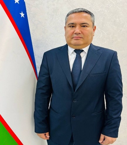
Bekchanov Qudrat Komiljonovich
- Reception hours:
- Monday, Wednesday · 14:00–16:00
- Phone:
- +998 97 364-27-77
Duties and areas of work
1. General duties
The tasks of the Institute of Soil Science and Agrochemical Research and of its Scientific Production Department include providing scientific services under service contracts to landowners, land users, clusters, farms, smallholdings and individuals; studying soil condition; assessing fertility; soil surveys; agrochemical analysis; mapping; and introducing research results into practice.
1. The department’s main goal
The main goal of the Scientific Production Department is to introduce the results of the institute’s research into production, organize scientific and practical services in soil science, agrochemistry, land evaluation and monitoring, provide scientific services to clusters, farms and individuals under service contracts, and develop science-based recommendations on the efficient and rational use of agricultural land.
2. Main duties
The department carries out the following main tasks:
organizes the introduction of the institute’s research results into agriculture and other sectors of production;
organizes scientific and practical work on studying the soil condition, fertility and agrochemical and agrophysical properties of agricultural land;
takes part in conducting soil surveys, laying soil profiles, taking soil samples and organizing laboratory analyses;
coordinates research to determine the humus content, available phosphorus and exchangeable potassium, salinity, texture and other agrochemical indicators of soil;
takes part in assessing the fertility of agricultural land, soil valuation and qualitative land evaluation;
takes part in studying soil salinization, erosion, degradation and other negative processes and in developing scientific and practical recommendations for preventing them;
takes part in producing thematic and digital maps, cartograms and databases based on soil and agrochemical research;
organizes the assessment of soil and land resources using GIS, remote sensing, GPS/GNSS, digital cartography and modern information technologies;
coordinates the office processing and analysis of field survey results and the preparation of scientific and practical conclusions;
carries out comprehensive research together with the institute’s laboratories and its field expedition, office analysis and cartographic analysis departments;
takes part in practical measures for rapid monitoring and diagnosis of soil condition;
prepares scientific and practical conclusions, reference notes and recommendations on land plots and agricultural blocks according to clients’ terms of reference;
implements measures to introduce new methods, technologies, methodological recommendations and research developments of the institute into production;
studies the effectiveness of introducing research results into practice and assesses their economic and environmental efficiency;
establishes scientific and practical cooperation with agricultural enterprises, farms, clusters, design organizations and other stakeholders.
3. The department’s practical workflow
Work in the Scientific Production Department is carried out in the following stages:
Stage 1 — accepting the order: the client’s requirements for the land plot, block or area are studied and terms of reference are drawn up.
Stage 2 — preparation: available cartographic, cadastral, soil, agrochemical and other data are collected and electronic maps of the area are prepared.
Stage 3 — field surveys: the natural conditions of the area are studied, soil profiles are laid, sampling points are marked and soil samples are taken.
Stage 4 — laboratory analysis: the samples are analysed using approved methods and the main agrochemical indicators of the soil are determined.
Stage 5 — office and GIS analysis: field and laboratory data are digitized and analysed, and thematic maps and cartograms are produced.
Stage 6 — scientific assessment: soil fertility, agrochemical condition, salinity, erosion, degradation and other indicators are assessed.
Stage 7 — developing recommendations: based on the results, science-based recommendations are prepared on efficient land use, preserving and increasing soil fertility and the rational use of fertilizers.
Stage 8 — introducing results into production: research results are applied in practice and their effectiveness is evaluated.
4. Main outputs of the Scientific Production Department
The department produces:
soil maps;
agrochemical cartograms;
digital soil maps;
soil fertility data;
soil valuation materials;
land evaluation results;
data on soil salinity and erosion;
agrochemical analysis results;
scientific and practical conclusions;
technical reports;
methodological recommendations;
proposals for efficient land use;
materials for introducing innovative developments.
5. Use of modern technologies
The department pays particular attention to improving the accuracy and speed of research by using modern GIS technologies, digital cartography, remote sensing data, GPS/GNSS technologies, aerospace imagery and, where necessary, unmanned aerial vehicles.
6. Final outcome of the department’s work
The main outcome of the Scientific Production Department’s work is linking the scientific knowledge and technologies created at the institute with practice, assessing the condition of soil and land resources scientifically, and developing practical solutions for preserving and increasing the fertility of agricultural land and using land resources efficiently.
The department’s work is closely linked to the institute’s established areas such as rapid monitoring of soil condition, soil fertility assessment, agrochemical research, mapping and introducing research results into practice.
Biography
Q.K. Bekchanov has 22 years of work experience.
Q. Bekchanov has worked at the Institute of Soil Science and Agrochemical Research since 2023. From 2004 to 2020 he worked as assistant registrar of the self-financing land management and real estate cadastre service of the Yangiariq district, Khorezm region, and held various positions in the cadastre system, including head of the Khorezm Regional Department of Land Resources and State Cadastre. From 2020 to 2023 he was deputy head of the Khorezm Regional Department of Agriculture.
In the institute’s Scientific Production Department he has organized scientific services under service contracts for landowners, land users, clusters, farms, smallholdings and individuals: testing the soils of land plots in stationary and mobile laboratories and giving scientific recommendations on planting layout and the science-based use of mineral fertilizers, taking into account soil and climate conditions, fertility, efficient land use and the nutrient supply of soils.
Main activities and achievements:
currently a second-year doctoral student at the doctoral department of the “Oʻzdaverloyiha” State Research and Design Institute; author of more than 10 scientific articles on land management projects;
active participant in national and international scientific conferences;
actively involved in developing international cooperation and establishing partnerships with foreign organizations;
contributed to the signing of memoranda of cooperation with research and educational institutions and organizations in a number of countries;
in 2016 he was awarded the badge “Excellence in the Sector” by the State Committee of the Republic of Uzbekistan for Land Resources and State Cadastre.
Since 9 February 2023 he has headed the Scientific Production Department of the Institute of Soil Science and Agrochemical Research.